Trail Truth

Coming to the App Store

Know what is open.
Know whose land it is.

An off-road riding map for iPhone. Forest Service roads and trails with the dates each one is open for your vehicle, BLM routes, parcel lines and public land, and your own rides recorded and kept on your phone. All in one app.

Northern California first. iPhone now, Android later.

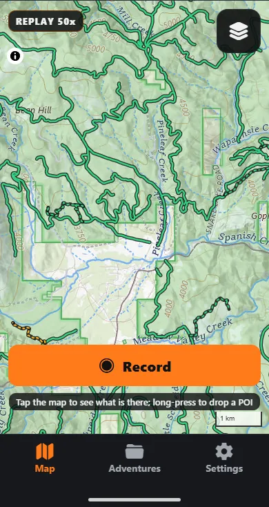
Trail Truth map over USGS topo in Plumas National Forest, dense with Forest Service roads drawn in green for open, one segment in amber for seasonal, and trails dashed.
Forest Service roads and trails over topo in Plumas National Forest. Green is open, amber seasonal, red closed, grey unknown.

Tap anything

Tap a road or trail and see its number, forest, status and the dates it is open for each vehicle: ATV, motorcycle, 4WD over 50 inches, high clearance and passenger car. That comes straight from the Forest Service Motor Vehicle Use Maps.

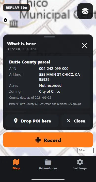
Tap a parcel for its APN, address, acres, zoning and the date the county data is from. Tap public land to see who manages it, and an OHV area for its designation. Drop a POI right there if you want to come back.
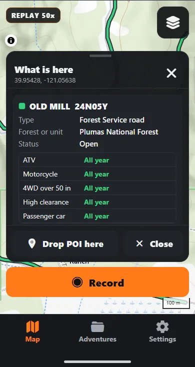
A What is here card for Forest Service road Old Mill 24N05Y in Plumas National Forest, status Open, open all year for ATV, motorcycle, 4WD over 50 inches, high clearance and passenger car.
Old Mill 24N05Y, Plumas National Forest: open all year for every vehicle.
A What is here card for a Butte County parcel in Chico showing the APN, address, acres, zoning City of Chico and County data as of 2021-06-22.
A Butte County parcel: APN, address, zoning and the county's data date.

The land, layer by layer

  • Forest Service roads and trails from the Motor Vehicle Use Maps, coloured by status, with per-vehicle open windows
  • BLM routes and BLM OHV areas
  • OpenStreetMap tracks, with duplicates of official routes removed, marked as not an official designation
  • Parcel lines and public land ownership
  • Topo, satellite, hybrid and streets base maps, with hillshade and 3D terrain

Every layer has its own switch, and every source is credited on the map.

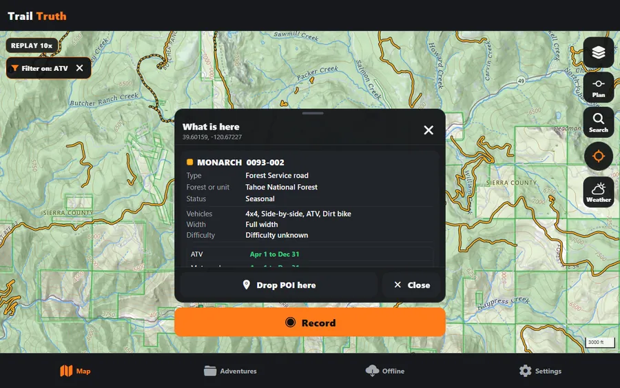
Map of Tahoe National Forest with the trail filter set to ATV and a card for Forest Service road Monarch 0093-002: seasonal, open to 4x4, side-by-side, ATV and dirt bike, full width, ATV open April 1 to December 31.
Filter on ATV, then tap a road: Monarch 0093-002 in Tahoe National Forest, seasonal, open to ATVs April 1 to December 31.

Filter to what you ride

Pick your vehicle (4x4, side-by-side, ATV, dirt bike, snowmobile, mountain bike or hiking), the width (single track, under 50 inches, full width), the difficulty, and hide what is closed. Where the data has no flag, the card says the answer is a guess instead of pretending.

Search

One box finds roads and trails by name or number, National Forests and BLM units, OHV areas, towns and places, and your own rides, routes and POIs. Nearby results come first.

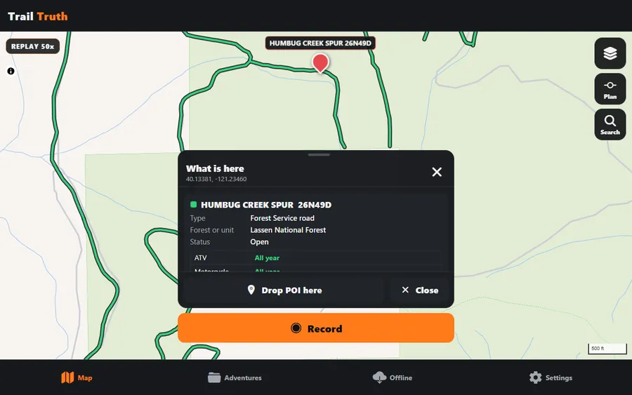
Search result picked on the map: a red pin on Humbug Creek Spur 26N49D in Lassen National Forest with its card showing Forest Service road, status Open, ATV all year.
Search "humbug", pick the road, and the map flies to Humbug Creek Spur 26N49D with its card open.

Record the ride, keep it yours

Record a ride with distance, speed, moving time and max speed on a glove-sized strip. Drop waypoints as you go, and POIs with notes and photos. Sort rides into folders, give them colours, write notes on them, and share a GPX by text or email. Bring tracks in from other apps with GPX or KML import.

Everything you record is private by default and lives on your phone. No accounts, no public heatmap of everyone's rides. Your single track stays off the radar.

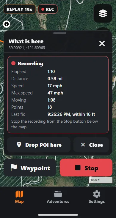
Satellite map during a recording, with a Recording card showing elapsed time 1:10, distance 0.58 miles, speed 17 mph, max 47 mph, 18 points and the last GPS fix within 16 feet, and Waypoint and Stop buttons below.
Tap the line you are recording for live time, distance, speed and GPS accuracy.

Navigate back

Pick a saved ride and go Back to start or To the end. A dial points to the track relative to the way you are facing, with the distance, the next waypoint, and a warning when you drift off the line.

Plan a route

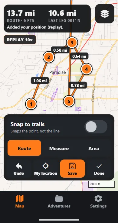
Tap to drop points and see each leg's length and bearing. Measure a distance, or draw an area and read its acres. Save routes and shapes to your folders and export them as GPX.

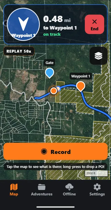
Navigate dial at the top of the map: an arrow pointing to Waypoint 1, 0.48 miles away, on track, over a satellite map with the saved track in blue.
Navigate: 0.48 mi to Waypoint 1, on track.
Plan mode near Paradise: five numbered points joined by legs labelled with their lengths, a total of 13.7 miles at the top, and Route, Measure and Area tabs below.
Plan mode near Paradise: numbered points, leg lengths, 13.7 mi total.

Fire, weather and snow

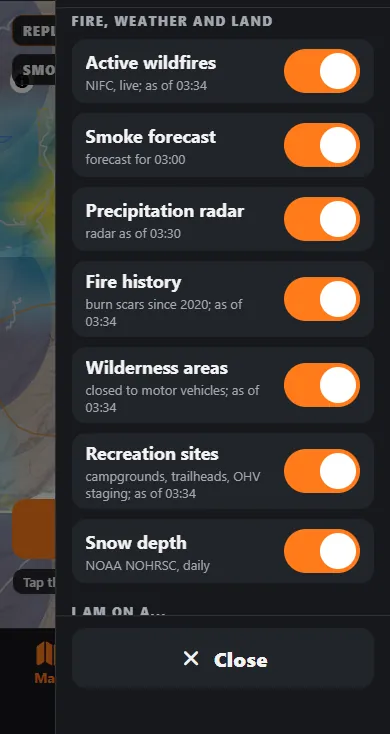
Live layers for active wildfires, smoke forecast, precipitation radar, fire history, wilderness areas, recreation sites and snow depth, each with the time it was last updated. Evacuation zones from CAL FIRE and Butte County, coloured by status. A weather sheet for wherever the map is, with National Weather Service alerts first.

The Fire, weather and land section of the map layers panel with switches for active wildfires, smoke forecast, precipitation radar, fire history, wilderness areas, recreation sites and snow depth, each showing its source and as-of time.
Fire, weather and land layers, each with its as-of time.

Built for no signal

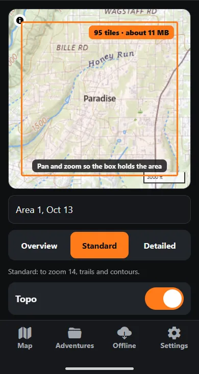
A lot of good riding has no coverage. Frame an area on the map, pick the detail, choose topo, satellite and the trail data, see the size, and download it before you go. Downloads wait for Wi-Fi unless you say otherwise, and you can pause, resume or delete them.

New offline area screen: an orange box framing Paradise on a topo map with a pill reading 95 tiles, about 11 MB, and Overview, Standard and Detailed quality choices below.
A new offline area around Paradise: 95 tiles, about 11 MB.

Where it works

Northern California first. That is where I ride and where the app gets proven, with parcel lines for Butte, Nevada and Shasta counties to start. The Forest Service, BLM, OpenStreetMap and public land data is already built for the whole country, so the rest follows.

Why I'm building this

I ride Northern California dirt. Too often I didn't know if a road was open to what I was riding, or whose land I was standing on. The answers were spread across different apps and a paper map. So I'm building one app that shows both, works where there's no signal, and keeps my tracks mine.

Ryan, Granary Games

Coming to the App Store